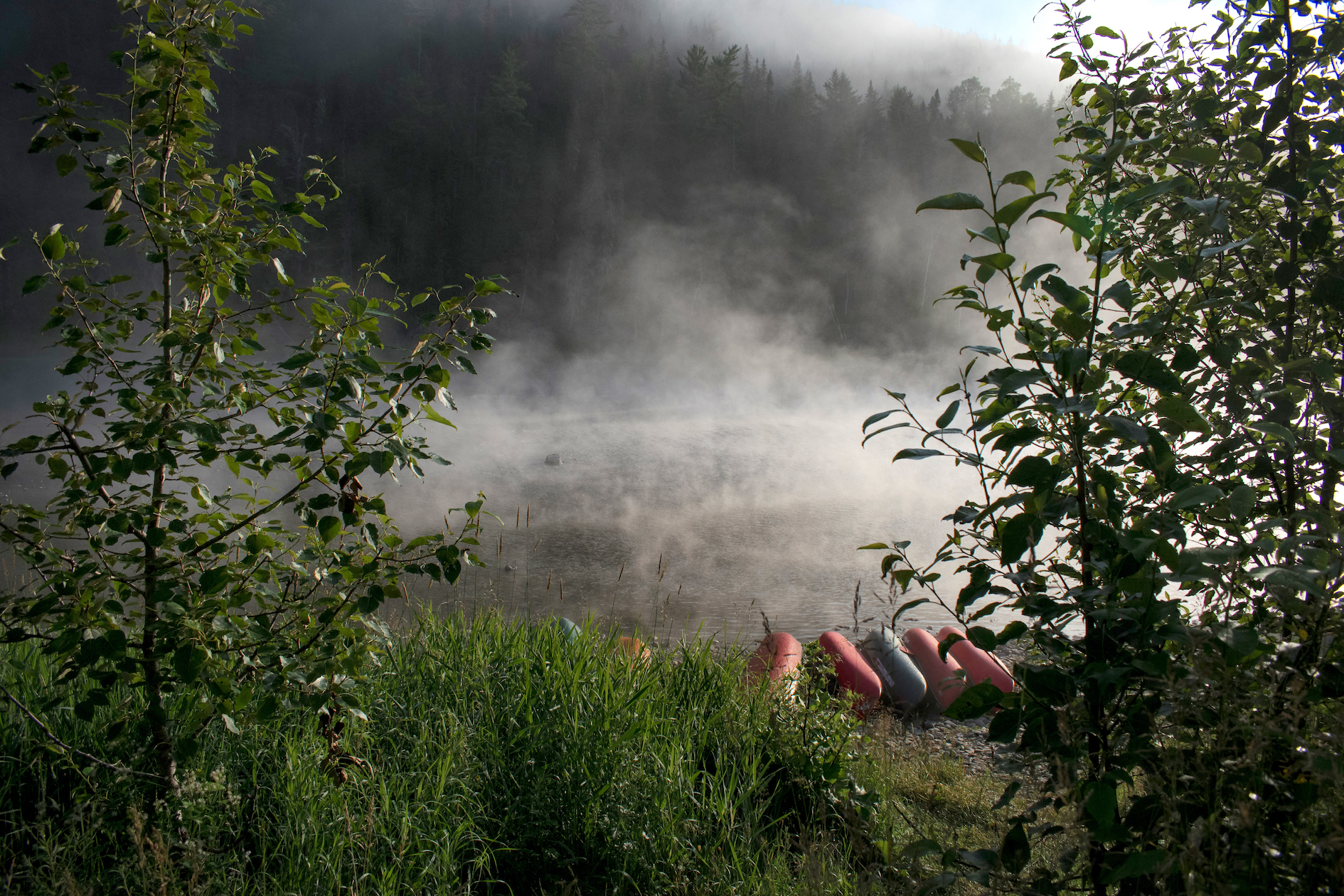
7 WONDERFUL RIVERS, TO DISCOVER!
Presentation and maps of the Matapedia area rivers, in Gaspesie, QC:
AVENZA MAPS – Download the Matapedia, Patapedia, Causapscal and Restigouche river maps with the Avenza Maps app… fishing pits, camping sites, rapids, fishing camps, etc.
MATAPEDIA RIVER
«THE ACCESSIBLE»
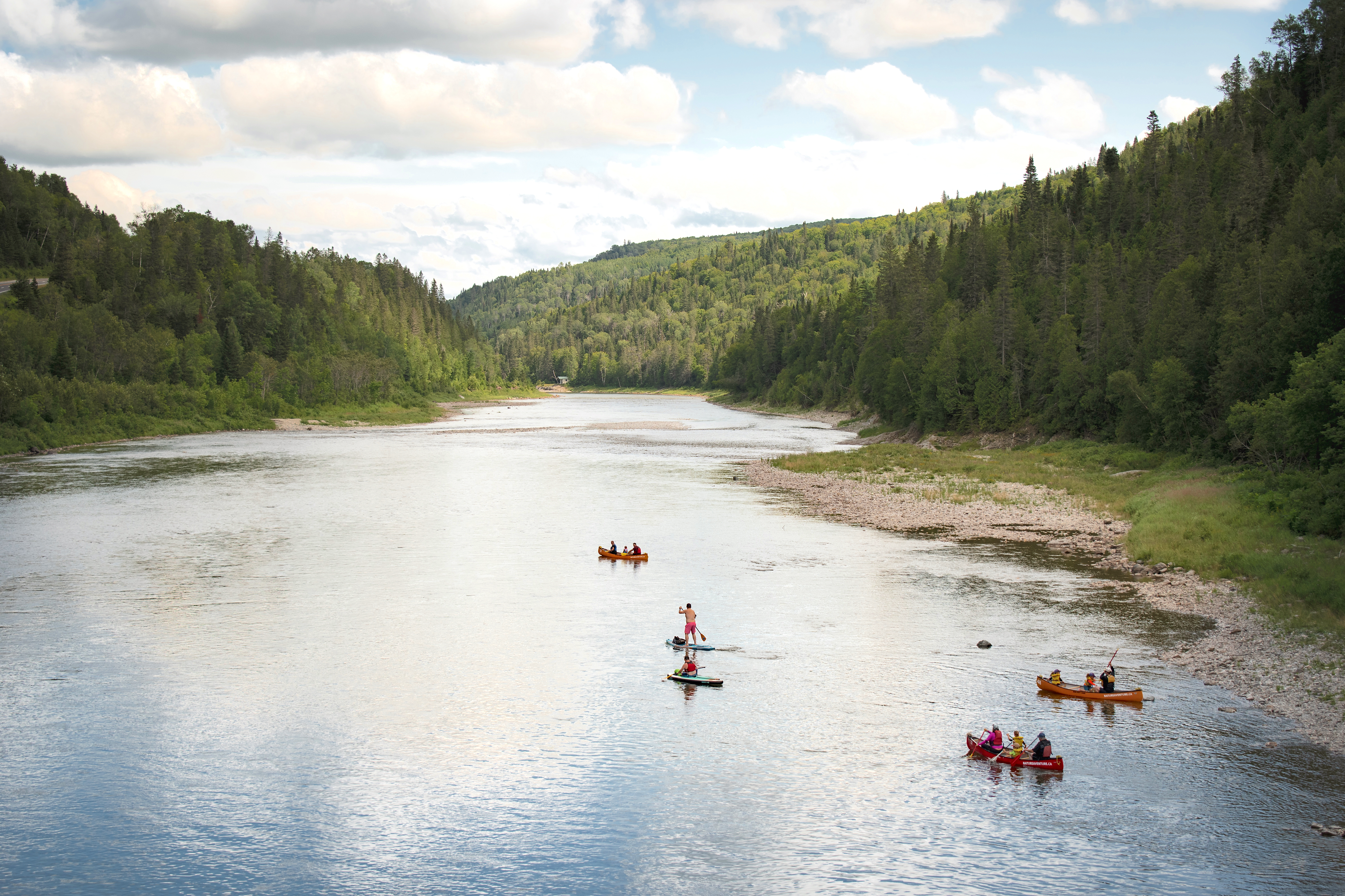
Difficulty level: beginner
It takes its source at Lake Matapedia and winds through one of the most beautiful valleys in Quebec on a distance of 87 km.
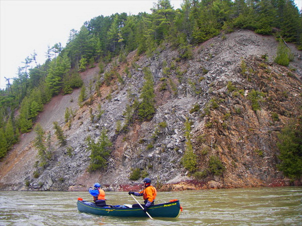
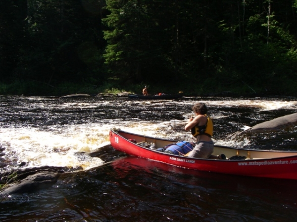
The wildest section of the river includes the Wildlife Reserve of the Matapedia River, which was created with the intention to protect the natural habitat of the salmon. Matapedia is one of the richest salmon rivers in Quebec. Throughout the descent, you will encounter numerous whitewaters: some R1, some R1-2, a few R2 (especially when the water’s high) and one R3 (named the Gates of Hell) which is just upstream of the mouth of the Assemetquagan River.
We offer various courses on this river. The shortest one is 8 km long, takes about an hour and a half to complete and is accessible to all.
For those who want a longer course, we offer one of 20 km, a 4 to 5 hours descent. We also offer a 2-day course and a 3-day course for those more experienced, since we will come across the R3 rapid. Portage of this rapid can be complex depending on the water level since the Route 132 and the railway run parallel to the river. For the 3-day course, departure will take place on the Causapscal River.
RESTIGOUCHE RIVER
«THE MAGNIFICENT»
Difficulty level: beginner
The Restigouche river, known worldwide for its salmon fishing, runs through a beautiful valley lined with mixed forests.
You can see fishing camps, bald eagles, the Appalachian Mountains, moose, white-tailed deers and several species of birds in their natural habitat. You can also observe the Atlantic salmon.
The first section of the Restigouche river is renowned for the beauty of its landscapes and, since 1995, it is part of the Canadian Heritage Rivers Network.
On the 90 km descent, we come across lots of calm waters, whitewaters, some R1 rapids, a few R2s (avoidable) and one R2-3 (also avoidable).
Families can experience this descent as it is for all types of paddlers. Courses range from 2 hours to 3 days, camping in rustic sites.
PATAPEDIA RIVER
«THE BALD EAGLE HIDEOUT»
Difficulty level: intermediate
The Patapedia river is located about 68 km west of the town of Matapedia. It is supplied by the lakes Superior and Hunter.
This narrow river winds through mountains on a distance of 70 km and flows into the famous “1 Million Dollar Pool” of the Restigouche River, known for the incredible number of salmon it contains. The lower part of the Patapedia is the natural border between Quebec and New-Brunswick. It is located amidst the forest and offers an unusual tranquility. The cold and clear waters of this river provide a unique habitat for the Atlantic salmon. Its fast flow allows you to go down this river without much effort; you simply need to steer your boat. You can go down this river when the water level is medium to high. In the section upstream of the 23 Miles Camp, the descent mainly consists of whitewaters, some R1 and some R2, with a constant slope. From the 23 Miles Camp at the junction of the Restigouche River, we find a lot of whitewaters and a few R1. This river, combined with the Restigouche River, allows you to go downstream for 90 km or more over a 3-day descent. When people choose to go down the Restigouche River, we use the “2 Miles” or “7 Miles” as our departure points.
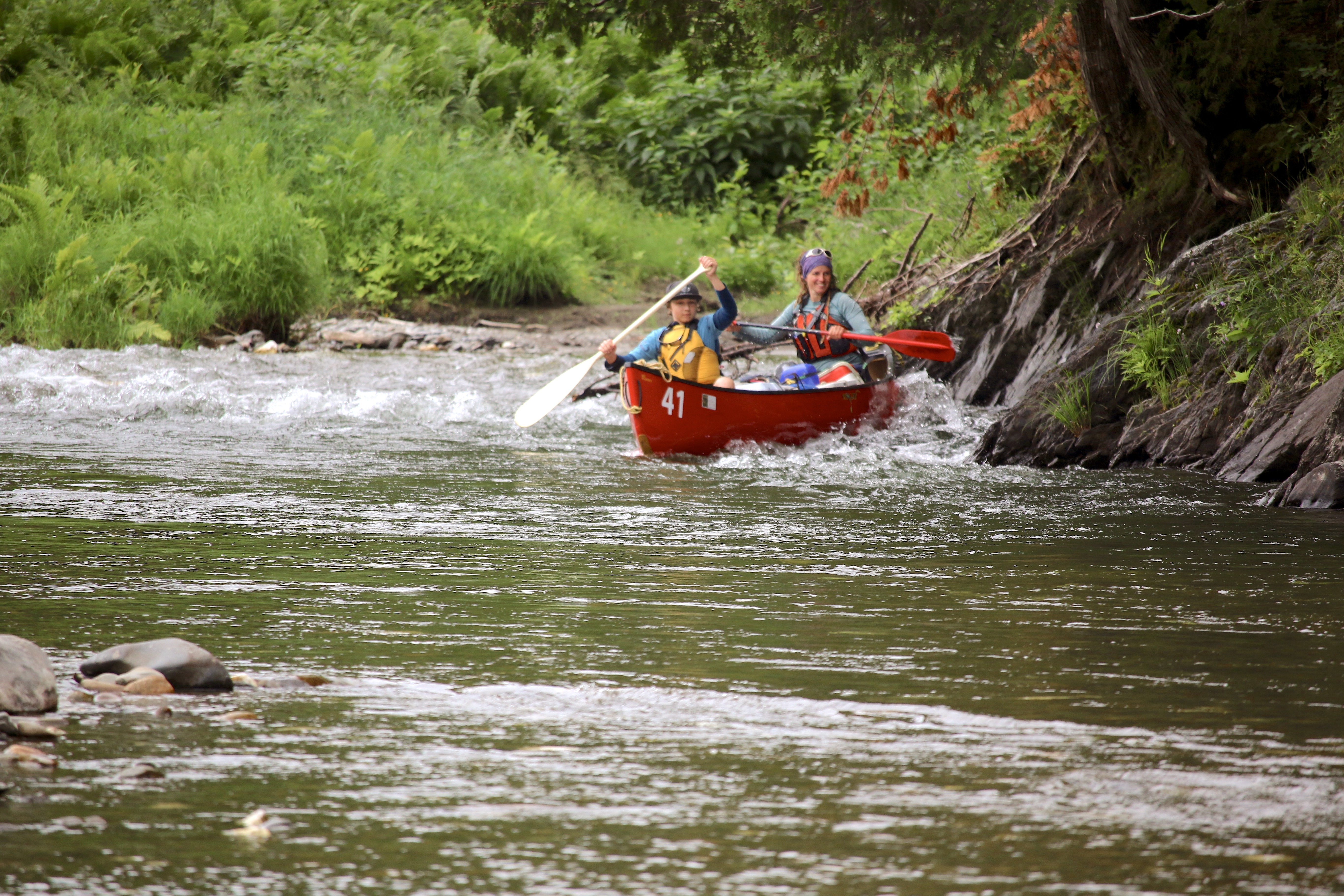
ASSEMETQUAGAN RIVER
«THE EARLY SEASON SPORTY ONE»
Difficulty level: advanced
If you like the challenge of paddling a river that splashes water up your face when you break waves, the Assemetquagan River is for you.
It takes its source in the heights of the Notre-Dame Mountain and the Chic-Choc Mountain, between the watersheds of the Nouvelle and Causapscal rivers. It flows south over a distance of about 50 km before joining the Matapedia River, about 20 km upstream from the village of Matapedia.
We offer a 30 km, one-day descent. In this course, at about 1 km from the start, there is a weir 2-3 (possible portage on the right). The descent continues with continuous whitewaters and a few R1 rapids. It ends with a series of R2-3 including weirs 2-3 (possible portage on the left).
Between rapids, observing Atlantic Salmons while snorkeling is possible on guided packages outings.
You can make this descent a 2-day course by adding the 20 km of the Matapedia river to reach our reception area!
KEDGWICK RIVER
«WHERE PLEASURE LASTS»
Difficulty level: beginner / intermediate
To extend your descent on the Restigouche, you can add up to 60 km by starting upstream of the Kedgwick River, before it joins the Restigouche river.
The Kedgwick river runs through stunning landscapes that will bring you peace and serenity.
The section we offer, starting from the forks, is available to all. This descent has whitewaters, a few R1 and one R2. The course is more difficult upstream of Camp 28 on the south branch and upstream of the forks on the northern branch. We recommend this section to experienced canoeists and only when the water level is high. R2 and R3 rapids, added to whitewaters and R1, are part of this section of the river.
It is likely that you will meet salmon fishermen as many are fishing in this lovely river.
This river is available for 4 days and 5 days courses (including 3 days on the Restigouche River).
UPSALQUITCH RIVER
«TALL PINES PARADISE»
Difficulty level: beginner / intermediate
This river in northern New-Brunswick flows into the Restigouche river, upstream of the “Rafting ground”.
You can choose between the southeast branch (for 2 days) and the northwest branch (for 2 or 3 days).
The southeast branch has its source in Lake Upsalquitch and can be paddled when the water lever is medium. It offers a 50 km descent on a 2-day course and has whitewaters and some R1 and R2 rapids.
The northwest branch is wilder and offers a greater distance of 90 km in 3 days. It is also possible to make a 2-day descent of 60 km or 48 km. This branch offers whitewaters and a few R1 and R1-2. It takes its source from a multitude of small streams that feed it and give it momentum throughout your journey.
As you progress on your adventure, the river keeps on growing. It then winds through a valley in the heart of the Appalachian mountains.
You will have the opportunity to see tall pines and several types of birds. The tranquility and beauty of the landscape will make you forget your everyday life!
CAUSAPSCAL RIVER
«THE REDDISH ONE»
Difficulty level: intermediate / advanced
This river takes its source in the Chic-Chocs highlands between two provincial reserves: Dunière and Causapscal.
It is very winding and narrow and has a nice regular slope to keep us in action!
Its reddish color is caused by flowing next to swamps located upstream.
The Causapscal river is navigable and interesting at high water level only.
We offer a 16 km descent, leaving from the falls and down to the mouth of the Matapedia River, in the heart of the village of Causapscal.
The first 6 km consist of almost continuous R1-R2, with some weir, and the last 10 km has whitewaters and some R1, with the exception of a short R2 at 500 meters from the end.
There is a boat launch for the last 10 km, at “Pont du Huit-Mille”.
This river is available for a course of 2 to 3 days by continuing on the Matapedia river to the village of Matapedia (where our reception area is located).